Copenhagen Maps and Orientation
(Copenhagen, Denmark)
The biggest city in the whole of Scandinavia and Denmark's capital, Copenhagen can be found on the far eastern side of the Zealand Island, within the Oresund region. Copenhagen is home to around 25 percent of all Danes and features a population of just over 500,000 residents.
Divided into a series of boroughs, the main areas of Copenhagen include Freetown Christiania, Norrebro, Osterbro, Sundbyoster, Valby and also the developing area of Orestad, on Amager Island, where Scandinavia's second-biggest shopping centre resides. The Copenhagen Metro network connects many of the main places of interest is these boroughs.
Maps and Orientation of the City
Central Station is Copenhagen's main railway station and often goes by the name of Hovedbanegarden. A major hotel zone stands directly west, while to the east, the ever-popular Tivoli theme park dominates much of the area. Free detailed maps of this area and the whole of the city are available at Copenhagen's tourist office and these even feature handy keys to find all of the many sights.
Central Copenhagen is home to the longest pedestrian mall in existence, the Stroget. Flanked by endless shops and cafes, this street stretches between the Radhuspladsen and also the public square of Kongens Nytorv, next to the attractive Nyhavn canal. Copenhagen's vibrant Latin Quarter is located directly north and is linked by numerous pedestrianised walkways.
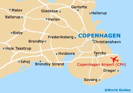
- Brondby - 8 km / 5 miles (11 minutes, south-west)
- Frederiksberg - 3 km / 2 miles (7 minutes, west)
- Gentofte - 10 km / 6 miles (13 minutes, north)
- Gladsaxe - 11 km / 7 miles (14 minutes, north-west)
- Herlev - 13 km / 8 miles (14 minutes, north-west)
- Hvidovre - 10 km / 6 miles (13 minutes, south-west)
- Lyngby - 13 km / 8 miles (14 minutes, north)
- Sovang - 14 km / 9 miles (20 minutes, south)
- Taarbaek - 16 km / 10 miles (22 minutes, north)
- Tarnby - 6 km / 4 miles (10 minutes, south)
- Valby - 5 km / 3 miles (8 minutes, south-west)
- Vallensbaek - 16 km / 10 miles (22 minutes, south-west)
Map of Denmark

Map of Copenhagen